GRFIN Helper
July 7, 2025
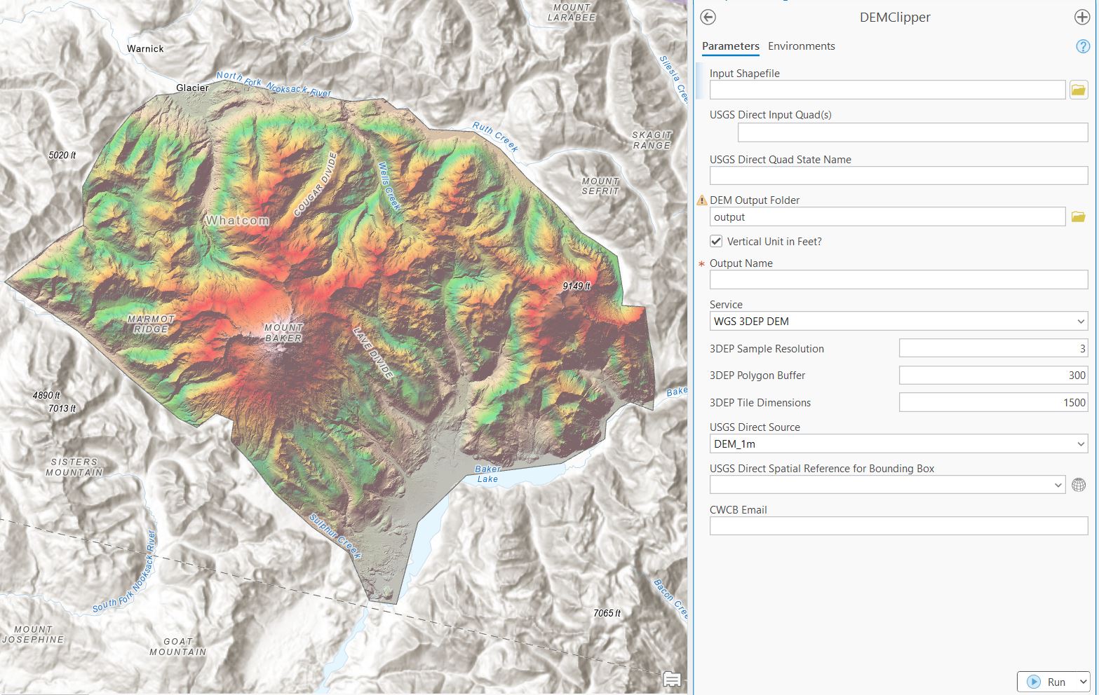
The DEM-Clipper accesses 3 federal and state collections of high-resolution LiDAR and DEMs. It contains a custom-developed tool for accessing the USGS 3DEP Webmap API, an adapted tool from Sam Johnstone at the USGS for direct access to USGS LiDAR, and a CWCB tool for accessing updated regions of Colorado is in development. Find the latest release of Sam Johnstone's Dem_getter here. Find the comprehensive CGS tool on the CGS github here.
(1) Johnstone, S and Miller, Q, 2024, dem_getter Python tool for acquiring digital elevation models and derivatives from The National Map, https://doi.org/10.5066/P13ZTT2N.