GRFIN Helper
July 7, 2025
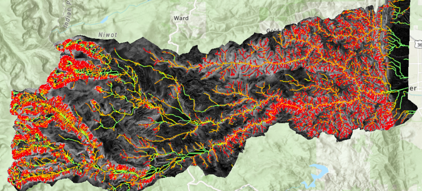
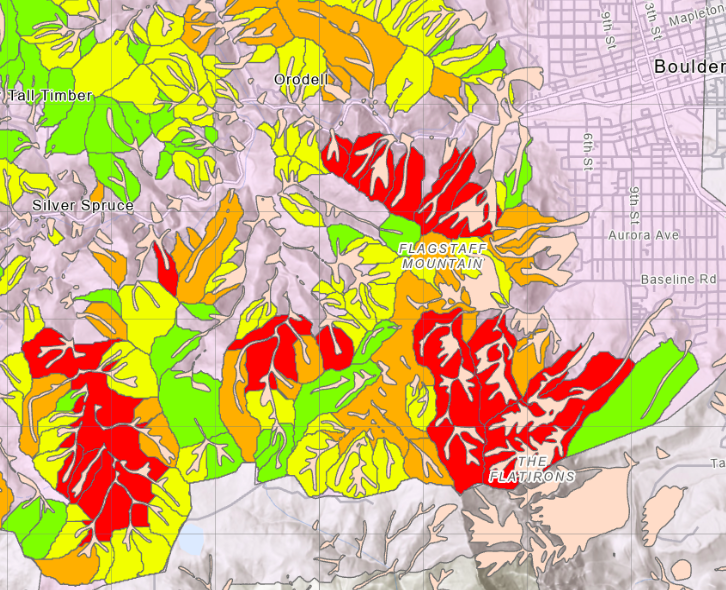
The original debris flow ArcGIS toolboxes were developed by DOGAMI (the Oregon Department of Geology and Mineral Industries) for ArcMap 10.x/ Python 2.x. The updated toolbox was upgraded for ArcGIS Pro/Python 3.x and calibrated for the CGS (Colorado Geological Survey). Original documentation, including instructions for calibrating to a specific area are located here. For access to the version which has been updated to Python 3.0, please contact Declan Knies at dknies@mines.edu.
For a presentation about the Colorado use of the program, including calibration and results, click here
(1) William J. Burns, Jon J. Franczyk, and Nancy C. Calhoun, 2022, Special Paper 53, Protocol for channelized debris flow susceptibility mapping, https://pubs.oregon.gov/dogami/sp/SP-53/p-SP-53.htm.